Waterfront property lines now a campaign issue
A walk on the beach sounds peaceful. But in Southold Town, where property lines have been a bone of contention between beachfront homeowners and people passing by on the shore, it’s now become a political issue as well.
“It started out as an issue that was somewhat minor about a decade ago but now, this seems to result in conflict on a much more regular basis,” said Southold Town Supervisor Scott Russell. “It’s a big issue, and it’s a growing issue.”
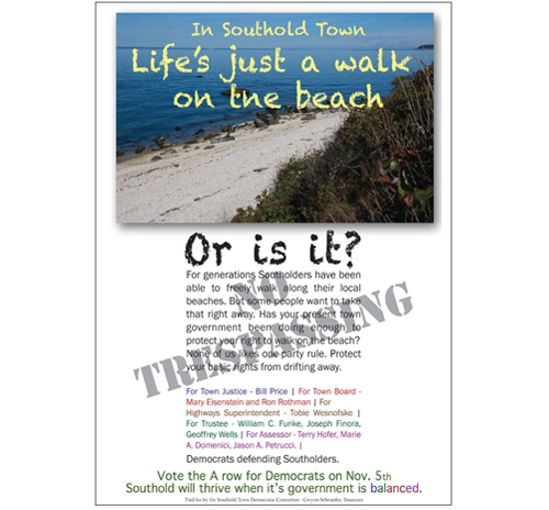
Last week, the full slate of Democrats running for town offices, currently all held by Republicans, purchased an advertisement in The Suffolk Times claiming that “some people” want to take away Southolders’ right to walk along local beaches and questioning if the present town government has been doing enough to protect those rights.
“Nobody likes one-party rule,” the ad states, alluding to Southold’s all-Republican Town Board and Board of Trustees. “Protect your basic rights from drifting away.”
“We’re just reacting to the number of complaints there have been from property owners who feel that the public walking in front of their property is a violation of their property rights, and I think the confusion stems from the interpretation of the mean high water mark, which is generally not understood,” said Geoffrey Wells, a Democratic candidate for one of three open seats on the town’s Board of Trustees.
The New York State Public Trust Doctrine says that anything seaward of the mean high water mark on the beach is public land, and anything landward of the mean high water mark on the beach is private property. The so-called wrack line, where debris washes up on the beach, is often looked at as an informal high tide mark, but it can change from day to day.
So how do you know where the mean high water mark is?
Both Mr. Russell, a Republican, and Mr. Wells agree there is no official document that defines where the mean high water mark is on Southold Town beaches. The mean high water mark is meant to be an average of the high tide mark over a 19-year period.
There have been several recent court cases on the subject involving beachfront properties on Long Island Sound in Mattituck. In one 2007 case, the court ruled in favor of a group of property owners after the state failed to defend the case. In another case in 2011, a court backed a Mattituck man who was accused of trespassing on private property along the beach near Mattituck Inlet.
The court cases reflect a general public confusion over the issue, as Mr. Wells has said.
“People don’t understand what the actual mean high water mark is, and they don’t know where it is,” Mr. Wells said. “The public and the homeowners are in a state of interpreting where the line might be. As part of our campaign, we’re saying let’s resolve this.”
He said the first thing that needs to be done is to revisit the mean high tide mark and either commission a survey to pinpoint exactly where it is or use existing surveys or aerial maps to do so.
Mr. Russell disagrees.
“On the issue of where the mean high water mark is, there’s a real technical problem with that,” he said. “You can ask five different surveyors and come up with five different answers.”
Other issues also complicate the matter, such as the fact that some waterfront property deeds reference the mean high water mark as being the end of the property, whereas other deeds give specific metes and bounds for a parcel but make no mention of the mean high water mark, Mr. Russell said.
“Ultimately, to find the mean high water mark, basically a surveyor or an engineer is out there trying to find the least erroneous answer to an unanswerable question,” Mr. Russell said. He said that even if the town undertook a plan to identify where the mean high water mark is, it would be subject to a challenge from beachfront property owners. The findings of such a venture would merely be an opinion and not a solid, technical answer to the question, he said, adding that it would also be a very costly undertaking.
Trustee president Jimmy King said he agrees with Mr. Russell that it would be impossible to formally locate the mean high water mark on all beaches within the town.
“I don’t see how it can be done,” he said. The public beachfront land along both the Sound and Peconic Bay in Southold Town is state land, Mr. King said, and it would be the state’s responsibility to mark the mean high water mark on those beaches, not the town’s.
Mr. Russell said he invited the secretary of state of New York to attempt to designate where the mean high water mark is, but that invitation has not yet been accepted.
Joseph Finora, another Democrat running for Trustee, says he believes there will be more conflicts in the future, especially in light of recent “superstorms” that will leave more of the beach under water and bring high tides closer to private property.
“In the future, the big picture answer is that we’re going to need greater cooperation among neighbors who live on the waterfront,” Mr. Finora said.