


Top Stories 2022: Wild weather in 2022, from summer drought to tornado touchdown

Mother Nature dealt the North Fork an unpredictable year in weather, from a near-historic late January blizzard to dire summer drought and an early fall tornado.
All of Long Island hunkered down on Jan. 28 as the National Weather Service issued a blizzard warning for Suffolk County — the first officially declared blizzard in four years.
The heaviest snow totals on Long Island were recorded in Orient, where 25 inches of snow fell during the storm.
A handful of power outages were reported and schools closed as residents dug out from two feet of snow. One storm-related fatality was reported in Cutchogue, where 77-year-old Robert Doroski died after falling into a swimming pool while he was out shoveling, according to Southold Town police.
Then, a prolonged summer heatwave and ongoing drought prompted the Suffolk County Water Authority to issue a Stage 1 Water Emergency for several East End towns by mid-August. Suffolk County was also placed on a statewide drought watch as more than 88% of the county was found to be “abnormally dry,” which led to concerns over stunted crop growth and wildfires.
The combination of high temperatures and scarce rainfall then meant the water emergency was extended to all 1.2 million of SCWA’s customers as the authority asked residents to cease non-essential water usage including lawn irrigation and long showers to ensure a sufficient supply for fire hydrants if needed.
According to data from the National Weather Service, just 1.27 inches of rain fell in July and even less — 0.67 inches — was recorded in August. Weather service data shows the average rainfall is 3.26 inches in July and 4.24 in August.
As the water emergency was rescinded in late September, another round of wild weather wreaked havoc on the Mattituck area.
On Sept. 25, a severe thunderstorm formed over the North Fork that resulted in an EF0 tornado touching down in Mattituck.
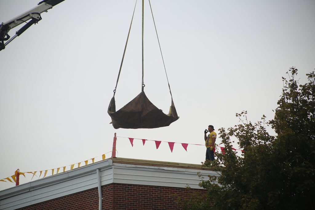
A survey team from the NWS confirmed the tornado appeared to have touched down for about three minutes, damaging greenhouses and large trees in Mattituck as well as Mattituck High School, which sustained damage to an outdoor scoreboard, fences and the gymnasium roof.
Winds were likely in the 75 to 85 mph range and the EF0 is the weakest on the scale of 0-5 on the Enhanced Fujita scale.


