Tropical storm conditions possible Friday as hurricane passes to east

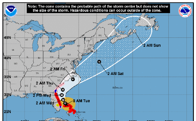
The East End may receive a glancing blow later this week from the outer edge of the deadly hurricane that has been stalled over the Bahamas and threatening the east coasts of Florida, Georgia and the Carolinas.
The National Weather Service issued a hazardous weather outlook, warning of tropical storm conditions possible Friday into Friday night. The center of Hurricane Dorian is on track to pass “well south and east.” However, wind gusts of 40 to 50 mph and locally heavy rain are still possible.
The slow-moving storm is expected to gain speed early Thursday morning once it’s off the coast of Georgia and South Carolina, according to the National Hurricane Center. The center of the storm should stay over water as it tracks up the East Coast.
The storm is currently a Category 3, according to the National Hurricane Center. It is expected to remain a powerful hurricane during the next few days. It had reached the maximum Category 5 status as it pummeled the Bahamas.