


Update: Blizzard warning in effect for the East End as snow approaches
Jan. 3, 3:45 p.m.: A blizzard warning is in effect for the East End from 1 a.m. on Thursday to Friday.
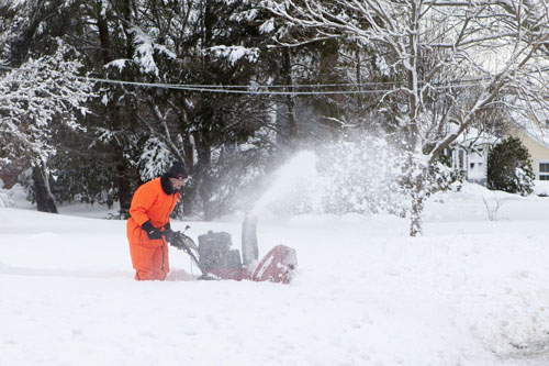
According to the National Weather Service, which issued the warning at about 3:15 p.m. Wednesday, travel will be very dangerous to impossible during the morning and evening commutes on Thursday. Snow accumulations remain around 8 to 12 inches for the eastern end of Long Island.
Damage to trees and power lines are possible and unsecured Christmas decorations still outside may be blown away or damaged.
Jan. 3, 8:35 a.m.: A winter storm warning is now in effect for the eastern end of Long Island starting at 1 a.m. on Thursday.
Blizzard conditions are possible with 6 to 10 inches expected to fall throughout the day, according to the National Weather Service. On the East End, 8 to 12 inches are possible, particularly on the South Fork since it’s closest to the offshore storm. “The further east you are the more snow to expect due to the track,” said Tim Morrin, a meteorologist with the National Weather Service in Upton. “It’s very conceivable to see pockets where you’ll see a foot or more by the time when you get into late tomorrow evening.”
The snow will begin to fall around 2 or 3 a.m. on Thursday in Suffolk County, and continue to pick up in intensity throughout the morning hours, Mr. Morrin said. It won’t taper off until the evening, between 7 and 10 p.m., he said. The winter storm warning is in effect for portions of southern Connecticut and Suffolk County. It ends at midnight on Friday.
“We do feel confidently that we feel this is a pure snow event with little to no mixing,” he said.
The morning and evening commutes on Thursday will be hazardous with heavy snow drifting due to strong winds. The National Weather Service said wind gusts could be as high as 45 to 50 mph, possibly causing power outages with downed tree limbs and power lines.
Plows will have a hard time keeping roads clear due to blowing snow, Mr. Morrin said. “Secondary roads will be rapidly snow covered and pretty much stay that way throughout the day.”
“It’s going to be impactful. It’s going to be hard to travel. It’s going to be dangerous to travel,” he said.
The cold temperatures are not going away anytime soon. “When the storm exists, the air mass behind it that’s going to come in Friday to Saturday is going to be colder than the one that came in around New Year’s,” he said. The high on Friday will be 12 degrees, with a low of 2 degrees Friday night. “It’s going to be quite brutal.”


