


NWS: Winter storm to spare North Fork heavy snow; dangerous cold Monday

A powerful winter storm that’s expected to move into the area Saturday night into Sunday is expected to spare the North Fork any significant snowfall, according to the National Weather Service.
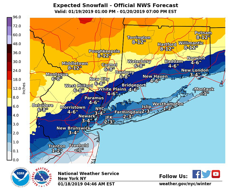
The storm is expected to bring primarily rain to the East End, while other parts of western Long Island will see between 2 to 3 inches.
Temperatures are going to rapidly decline Sunday into Monday with a 30-degree drop. The high Sunday is around 40 degrees and by Monday morning it will fall near single-digits.
“You’ll feel it Monday morning when you step outside,” said Carlie Buccola, a meteorologist with the National Weather Service in Upton.
The storm is expected to make its way to the area between 5 and 8 p.m. Saturday.
The NWS warns of “dangerous wind chills around 10 below zero” Sunday night into Monday morning. The freezing temperatures will create a potential flash freeze problem on roads that are untreated.
Moderate coastal flooding is also possible with the Sunday morning high tide cycle, according to the NWS.
The heavy snow is expected in areas of northern Connecticut and north of Westchester County.
The first snowfall of 2019 arrived overnight Thursday into Friday with minimal accumulation.
Photo Credit: National Weather Service


