


Late-winter storm to bring 5-7 inches of snow, NWS says

The light snow that fell Saturday morning was nearly gone by the end of the day, but a more significant late-winter punch is on its way.
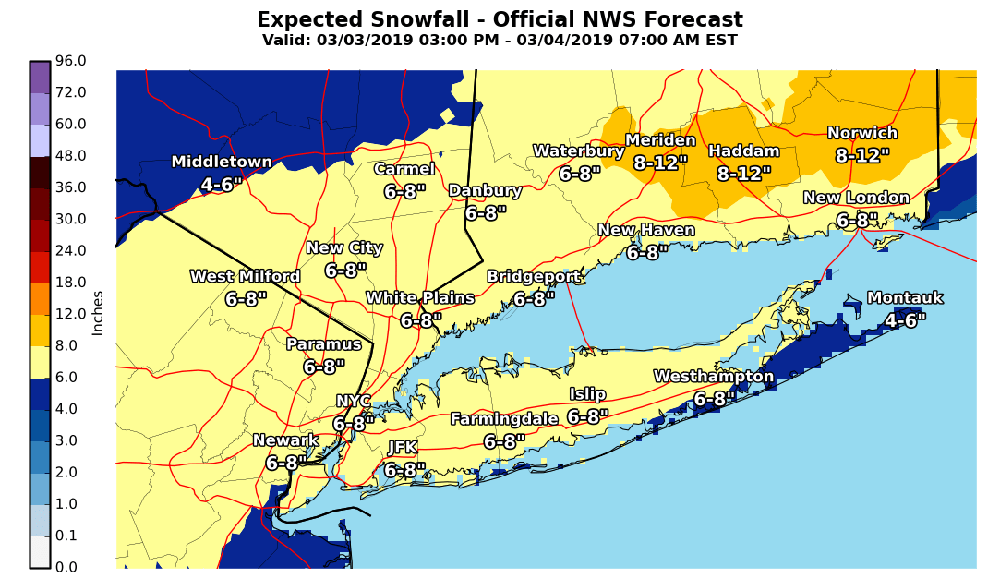
The National Weather Service upped its projected snow totals overnight for a storm that’s expected to hit the area late Sunday afternoon through Monday morning. A winter storm warning goes into effect at 1 p.m. Sunday and will last through 7 a.m. Monday as moderate snow, heavy at times, is expected.
An estimated five to seven inches of snow is expected, putting the storm on pace for the highest total so far this winter, according to the NWS. Amounts may be lower across the South Fork as rain mixes in late tonight. The eastern most portion of the North Fork could see the highest totals locally.
The snowy weather could make travel difficult Sunday night and for the Monday morning commute, potentially impacting schools. Visibility could be 1/2-mile or less at times during the storm. The heaviest snow will be during overnight hours.
The temperature is expected to climb Monday afternoon as the storm passes, giving way to clear skies. The high temperature is going to be near 41. Mostly sunny skies are forecast through Friday.
Editor’s Note: This post was updated at 5 p.m. with the latest information from the NWS.
Photo credit: National Weather Service


